|
|
Post by nascarfan999 on Dec 15, 2019 0:39:28 GMT -6
Where can we get current road temp information? I can’t find it on the app MoDOT uses. I don't believe it is publicly available for Missouri. |
|
|
|
Post by nascarfan999 on Nov 11, 2019 7:54:02 GMT -6
The have-nots will be in the snow hole capital of the worrrrrrrrrrrld...Marissa, IL. Gonna have to battle Union for that title. |
|
|
|
Post by nascarfan999 on Sept 22, 2019 16:32:56 GMT -6
|
|
|
|
Post by nascarfan999 on Sept 2, 2019 20:23:38 GMT -6
this is incredible if real. Looks legit to me. Haven’t seen a lot come out of there yet but what I have seen has looked similar to this and worse. More should be revealed in the coming days. I have full confidence that it is real. The individual who made the video has several other videos on Facebook throughout the day. It sounds like this is from the eastern edge of Freeport. |
|
|
|
Post by nascarfan999 on Sept 1, 2019 17:51:49 GMT -6
The fact that the “major” media weather network continues to put its eggs all in the EURO’s basket is a bit discouraging. I hope for the sake of the people in the central part of Florida, the EURO and GFS are right. There should just be more stress on “plan for the real possibility” it won’t turn. People just stare at the graphic of the cone and less informed people will just say “it will miss us”. The odds are it will miss. The euro/gfs combo along with ensembles is stronger than the HWRF. The HWRF is enough to make you think twice though Not to mention that some of the ensemble members do make landfall as well, although not many. |
|
|
|
Post by nascarfan999 on Aug 30, 2019 20:09:33 GMT -6
Did the soccer field and baseball fields at Eureka high school go under again today? They were playing soccer on the field when I came by this afternoon about 4. Also, someone posted a pic of the scating rink in Sullivan on Facebook. Suspected tornado. There was a report, pretty sure on FOX2, that they were underwater again this afternoon. Edit: I actually think they said it was per Chris. |
|
|
|
Post by nascarfan999 on Aug 27, 2019 21:04:46 GMT -6
A 9 minute rain delay in Milwaukee for the Cards/Brewers game. The roof was open and it started pouring. I remember at the start of the game they said it was a beautiful night for baseball, the roof is open. I wonder if 9 minutes is a record shortest time for a rain delay. . Not only is it not the shortest rain delay in MLB history, it isn't the shortest rain delay in Miller Park history. They had a similar incident in 2012 which led to a 7 minute rain delay. |
|
|
|
Post by nascarfan999 on Aug 21, 2019 21:04:53 GMT -6
St. Louis radar is down for repairs. Use the terminal radar at Lambert Can send out a link? I'm having trouble finding it. Thanks! We have had heavy rain here in Wildwood, seems to have slowed down a bit now. I use weather underground to view the terminal radar - linkAlso, 141 is closed under I-44 apparently due to flooding. |
|
|
|
Post by nascarfan999 on Aug 13, 2019 20:16:09 GMT -6
Just read that WIU is getting a dual-pol doppler radar...that will be a great asset for the region! This is great news for the Tri-State area as that area is a big dead zone between STL, KC, Quad Cities, and Lincoln radars. Speaking of radars, I see the local radar site will be down next week for maintenance, although as far as I know the immediate metro will still have the terminal radar to use. Also, the NWS twitter account announced yesterday that a new NWS radar website is coming. The text from the tweet is below. Coming in 2020: A new NWS Radar website! Featuring: ✔️Mobile-friendly layout ✔️Dynamic zooming/scrolling ✔️Level 2 data ✔️GIS services ✔️Social-media friendly animations |
|
|
|
Post by nascarfan999 on Aug 11, 2019 20:38:50 GMT -6
Wife said she had a few drops on her windshield near hear this afternoon. Not even enough to turn on the wipers See any flash flooding with that I'm sure that was occurring about 2 miles to his south at the summit. |
|
|
|
Post by nascarfan999 on Aug 9, 2019 20:14:56 GMT -6
What is easiest way to upload from my iPhone? Also was there an earthquake today /this morning?? Someone reported radio had indicated it but didn’t know the strength? Guess I’ll research that too as I figure out how to upload image. Yes, there was a 2.0 earthquake just NE of Farmington. We don't get too many that far north, but they are very common down into the bootheel and western Kentucky/Tennessee. USGS Page for Earthquake |
|
|
|
Post by nascarfan999 on Jul 20, 2019 21:24:16 GMT -6
Looks like it’s trying to move/develop more west. East side may miss this one if it makes it here. I was just saying the same thing. Glad I'm not the only one that noticed that. Lol Forget Illinois, I think this may miss then entire metro to the west should it hold together. |
|
|
|
Post by nascarfan999 on Jul 17, 2019 17:12:44 GMT -6
very unimpressed by the amount of rain with this storm, not that I'm complaining.
|
|
|
|
Post by nascarfan999 on Jul 15, 2019 5:53:25 GMT -6
Looks like somebody at FOX2 has the Blues on their mind a bit too much this morning...   |
|
|
|
Post by nascarfan999 on Jul 5, 2019 18:17:05 GMT -6
30 minute downpour = 2.8" of rain according to the Davis on the roof in North St. Pete. I knew it came down hard. The retention pond filled up in a hurry. But that's the most we've had all week. Prior to that the most was a couple hundredths. I don't have amounts and wasn't home when it happened, but I can confirm north St. Charles had a ton of rain and evidence of some flash flooding issues prior to 5:30pm. |
|
|
|
Post by nascarfan999 on Jul 3, 2019 17:34:54 GMT -6
Finally got a little rain. But, given the amount of lightning and thunder, not nearly as much as I would have expected. Should've gone about 3 miles to the east. St. Charles really got soaked between 5-6pm. |
|
|
|
Post by nascarfan999 on Jun 25, 2019 19:32:08 GMT -6
700 temps under that axis stay relatively cool... never going above 10*C thru the week. The capped airmass looks to be well north & west of the area. Some big CAPE numbers each day too... but nothing noticeable on the models to trigger anything off. If something does develop- they will be slow movers and outflows will cause more development. Looks like the classic "airmass" setup with isolated convection possible almost every day but quiet overall with upper ridging in control. The NW flow looks like it will try to become established again into July. Am I correct to interpret this in layman's terms as "hot, humid, and a chance of rain for the foreseeable future"? |
|
|
|
Post by nascarfan999 on Jun 22, 2019 22:47:58 GMT -6
As a whole that line is almost stationary. Definitely not good for the Missouri River basin.
|
|
|
|
Post by nascarfan999 on Jun 21, 2019 18:51:08 GMT -6
Happy today's shift is over. Just not really happy with how things went... on air or with the forecast. Im still trying to figure out a good workflow that I am comfortable with during severe weather on the AM shift... and I am not there yet. I thought it went well, but I'm no expert! I would agree and think the forecast I saw at 7am matched up very well with what happened. I will say I was expecting Chris to hedge a little more on-air given the uncertainty here in the forum, but again the result turned out really good I think. |
|
|
|
Post by nascarfan999 on Jun 21, 2019 12:16:17 GMT -6
Per the STL NWS twitter, the radar site was down due to a lightning strike, but it now back up and running.
|
|
|
|
Post by nascarfan999 on Jun 15, 2019 13:03:25 GMT -6
Is there a worst scenario for the local TV stations than a tornado warning during the parade? Especially for FOX2 as their coverage is shared with FSMW and I believe the NHL Network.
|
|
|
|
Post by nascarfan999 on Jun 15, 2019 9:54:54 GMT -6
Chris, I hope it is mostly leisure time for you going DT and not just work related. Stay safe everyone. I had a family party scheduled at the new house for a awhile. We already have calls saying they will be late because of watching it on TV. How rude.:-) I'm pretty sure he is going as a fan, although based on his twitter he had to wait over an hour at the Brentwood Metrolink station for a train. Sounds like a lot of the Metrolink system is just completely overloaded, especially the Missouri portion of the Blue Line. |
|
|
|
Post by nascarfan999 on Jun 12, 2019 18:06:26 GMT -6
Is this the right setup for those cold core funnels (not sure if that's the correct term)? I seem to recall similar weather in May about 10 years ago that produced them. My brother is in Millstadt and swears a funnel briefly hit the ground. I did see a speck of weak rotation show up on the radar. From the St. Louis NWS Twitter: "Receiving reports of a funnel cloud from a storm just south of Smithton, IL. Storm continues to move to the southeast at around 20 mph. Rotation remains weak, but may continue to produce a funnel cloud. We're keeping an eye on it for you." |
|
|
|
Post by nascarfan999 on Jun 4, 2019 16:52:59 GMT -6
Well i guess anybody north of 70 is missing out on storms tonight.... Thank goodness. |
|
|
|
Post by nascarfan999 on Jun 3, 2019 19:14:38 GMT -6
Anybody know what is going on with the Missouri River at St. Charles? The level is rapidly and unexpectedly dropping and I'm not sure if there's been a breech in the area or if it is a gauge malfunction. I thought I heard on the way home on 1-1-2-0 that a breach had occurred? I have checked every TV station, 1120, and Post websites plus my facebook feed and can't find anything. Looking at the gauge it looks like a breech as the fall has been consistent and reasonable since noon. However, it is now down over 2 feet which I'd think would have to be a pretty significant breech somewhere if the readings are accurate. |
|
|
|
Post by nascarfan999 on Jun 3, 2019 18:22:26 GMT -6
What's everyone thoughts on the meramec river in Arnold I'm think I55 will be shut down if we get more rain The "good" news is that pretty much all of the Meramec flooding thus far has come from Mississippi backwater and not from the Meramec basin itself. Every flood is unique and this one is way different than the ones that saw I-55 close (or almost close) in recent years. What is encouraging is that the best analog we have (1993) was still a foot or 2 lower than the recent floods at the Arnold gauge. In addition, I-55 is slightly upstream from that gauge and the further upstream you get the less of an issue backwater is. I definitely would not rule it out, but taking this into account my gut says we would need more rain than is currently forecasted to raise the rivers enough to close I-55. I will also add that river crossings further upstream from I-55 such as Tesson Ferry/MO 21, MO 30, or MO 141 would be even less likely to close as long as the Meramec flooding is primarily driven by backwater. All that said, anyone near the river or using river crossings should consider what their action plans would be in case the rivers do rise more and in case of drivers what alternatives you may have if faced with road closures. |
|
|
|
Post by nascarfan999 on Jun 3, 2019 18:10:43 GMT -6
Anybody know what is going on with the Missouri River at St. Charles? The level is rapidly and unexpectedly dropping and I'm not sure if there's been a breech in the area or if it is a gauge malfunction. 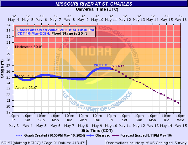 |
|
|
|
Post by nascarfan999 on Jun 1, 2019 21:05:08 GMT -6
Sure sounded like 15-30 seconds of hail with this latest round, but by the time I got to the door it had stopped and in the darkness I could not see any hail stones on the ground.
|
|
|
|
Post by nascarfan999 on Jun 1, 2019 18:51:16 GMT -6
Pea sized hail 3N St. Charles still in progress.
Update: Largest measured at 1/2" and hail has now stopped.
|
|
|
|
Post by nascarfan999 on Jun 1, 2019 17:53:30 GMT -6
That cluster might bow out and come right down the river eh? Looks like you might have been right on cue...looks like a gust front starting to form in front of it. |
|


