|
|
Post by guyatacomputer - NE St. Peters on May 18, 2024 6:55:06 GMT -6
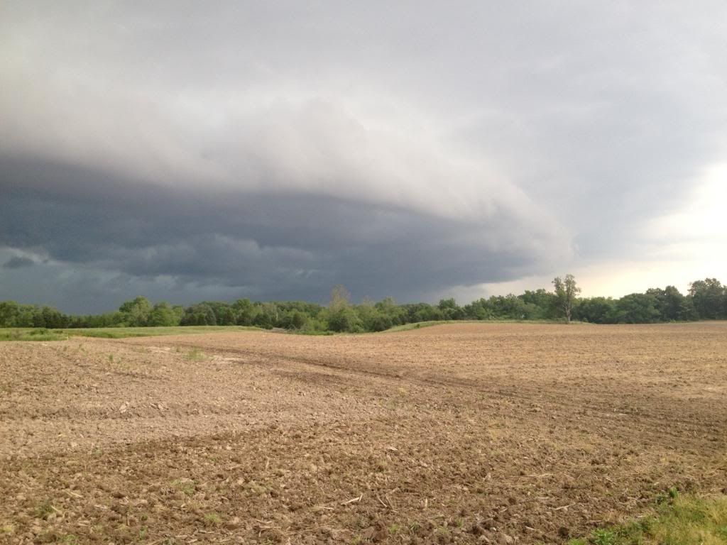
Tuesday is looking even more threatening
|
|
|
|
Post by guyatacomputer - NE St. Peters on May 17, 2024 16:39:33 GMT -6
Missed rain today by a half mile Need to watch Tuesday for severe potential I was just about to post the same thing. Wednesday could also be a problem though the NWS doesn't go out that far  |
|
|
|
Post by guyatacomputer - NE St. Peters on May 15, 2024 20:10:51 GMT -6
More water on its way down the Missouri. Heavy rain and flash flooding in the Omaha area this evening.
|
|
|
|
Post by guyatacomputer - NE St. Peters on May 15, 2024 9:41:28 GMT -6
The Davis on the roof in North St. Pete reports that we were mostly missed yesterday, compared to some of you. He says .28" I knew we didn't get a whole lot. I was surprised to hear about all the flooding. Definitely a feast or famine situation. |
|
|
|
Post by guyatacomputer - NE St. Peters on May 14, 2024 19:16:46 GMT -6
I'm starting to get concerned about river flooding heading into summer with the current elevated flows, saturated ground and model forecasts showing a spray of shortwaves in the S stream over the next couple weeks. This seems to be a different animal than the last couple seasons that were dominated by dry conditions overall. I'm also getting cool and rainy summer vibes with frequent amplifications in the N branch across the Lakes/NE knocking back the thermal ridge being advected E/NE into our region and an active MCS train. It's been a while since we've had a truly cool summer...2013 was the last one that I recall. Quite a breakneck switch from all the drought concerns. I was trying to figure which event(s) and when broke the back of the drought. |
|
|
|
Post by guyatacomputer - NE St. Peters on May 14, 2024 4:49:44 GMT -6
Yep- not really a cold core system- lapse rates aren’t great Must have been better down around Branson. Payne's valley golf courses had a tornado today with zero warning. Also a tornado report in nw mo today. Glen Zimmerman reported those weren't true tornadoes. Called them "cold draft" or something like that. |
|
|
|
Post by guyatacomputer - NE St. Peters on May 9, 2024 5:19:48 GMT -6
Our neighbor, a business, has damage caused by the winds knocking down a power line. It managed to catch a vinyl fence on fire, melting 30-40 feet of the fence, causing the molten plastic to drape down over their retaining wall.
|
|
|
|
Post by guyatacomputer - NE St. Peters on May 8, 2024 14:15:12 GMT -6
Sunny here in St.peters, also very windy Those winds knocked a power line off the pole and start a fire in the lot next to our house. Fire dept arrived and put it out. Fortunately I still have power. |
|
|
|
Post by guyatacomputer - NE St. Peters on May 8, 2024 9:41:14 GMT -6
Getting a bit darker in far north St. Peters. The MCS appears to be heading right towards metro STL.
|
|
|
|
Post by guyatacomputer - NE St. Peters on May 7, 2024 19:54:50 GMT -6
Is anyone able to view this morning's radar and tell me if there is any evidence of a spin-up at 38.392406, -90.041064? There was a roof blown off a shed and deposited to the north of its location. Line was in that area around 5am, but I didn't see anything on radar. Sometimes QLCS tornados spin up and down very quickly so it's possible something happened between velocity scans. And lower intensity and short lived tornadoes wouldn't throw up a debris ball. |
|
|
|
Post by guyatacomputer - NE St. Peters on May 7, 2024 12:23:14 GMT -6
This definitely caught my attention from the NWS The top 2 CIPS analogs for Wednesday`s event are two of our more significant May events in the past 20 years: May 8, 2009 derecho (https://forecast.weather.gov/glossary.php?word=derecho) (80- 100 mph winds) and May 6, 2003 tornado (https://forecast.weather.gov/glossary.php?word=tornado) outbreak that resulted in 21 tornadoes in our cwa (https://forecast.weather.gov/glossary.php?word=cwa) . Interesting to note the dates on those two events given today's date is May 7. |
|
|
|
Post by guyatacomputer - NE St. Peters on May 7, 2024 4:46:12 GMT -6
Tornado warned storm was a weak thundershower. I don't think the birds even stopped singing.
|
|
|
|
Post by guyatacomputer - NE St. Peters on May 6, 2024 9:34:22 GMT -6
And Wednesday into Thursday is concerning for us.
|
|
|
|
Post by guyatacomputer - NE St. Peters on May 6, 2024 9:30:06 GMT -6
Scary for folks in Central Oklahoma and South Central Kansas
|
|
|
|
Post by guyatacomputer - NE St. Peters on May 4, 2024 14:41:56 GMT -6
At 340 pm I have a thunderstorm with pea sized hail.
|
|
|
|
Post by guyatacomputer - NE St. Peters on May 4, 2024 10:39:08 GMT -6
The SPC has the area in 15% risks for Tuesday and Wednesday next week. CSU is going wild next week. Where do you find the CSU maps? |
|
|
|
Post by guyatacomputer - NE St. Peters on May 4, 2024 0:05:44 GMT -6
From Omaha south to central TX is getting pounded again tonight. Thay have to have some crazy precipitation accumulation numbers for the last few weeks.
|
|
|
|
Post by guyatacomputer - NE St. Peters on May 1, 2024 20:14:24 GMT -6
Looks like an MCV is headed our way out of the Ozarks this evening... Went by to the south of me. I got nothing. |
|
|
|
Post by guyatacomputer - NE St. Peters on Apr 29, 2024 14:54:07 GMT -6
24hr rainfall - 1.29" in Marissa, according to Chili Davis on the swing set. There's a blast from the past. |
|
|
|
Post by guyatacomputer - NE St. Peters on Apr 29, 2024 8:18:11 GMT -6
Even the major rivers are going to marginally go into flood. Wouldn't have guessed that a month or two ago.
|
|
|
|
Post by guyatacomputer - NE St. Peters on Apr 29, 2024 2:06:49 GMT -6
Some of this thunder...wow! I think it's going rattle the nails in the walls of the house loose.
|
|
|
|
Post by guyatacomputer - NE St. Peters on Apr 28, 2024 9:06:29 GMT -6
Even with the sun out now the atmosphere won't destabilize much?
|
|
|
|
Post by guyatacomputer - NE St. Peters on Apr 27, 2024 12:56:05 GMT -6
I probably 'should' know this answer, looking at the SPC map just posted here, were there 100 'separate' tornadoes or was multiple sightings of the same tornado counted? I am in 100% agreement with the above posts of no fatalities occurring and advanced warnings along with the multitude of chasers/public streaming of it surely helped with that. I was wondering if the 4 tornadoes at once clustered together that I saw counted as one tornado or four. |
|
|
|
Post by guyatacomputer - NE St. Peters on Apr 26, 2024 19:17:58 GMT -6
Fox Weather is showing live a horrible set of tornadoes - 4 of them together - near Shelby, IA. Just devastating.
|
|
|
|
Post by guyatacomputer - NE St. Peters on Apr 26, 2024 15:08:58 GMT -6
Nasty tornado cell heading towards Omaha & Council Bluffs.
|
|
|
|
Post by guyatacomputer - NE St. Peters on Apr 23, 2024 13:17:45 GMT -6
Wasn't expecting much today but the thunder we are getting in Troy, MO is rattling windows. Thunder in far north St. Peters is considerable, as well. And it's pretty dark, too. I was expecting brief light showers but this is a bit more substantial than that. |
|
|
|
Post by guyatacomputer - NE St. Peters on Apr 20, 2024 10:41:26 GMT -6
I am so sad to share that MoSue passed away on April 19. Rest in peace Sue. Sorry to hear that. R.I.P. |
|
|
|
Post by guyatacomputer - NE St. Peters on Apr 19, 2024 19:42:59 GMT -6
Bore  My wife says I'm a bore, but that's a different story. I was thinking of making a similar joke. |
|
|
|
Post by guyatacomputer - NE St. Peters on Apr 18, 2024 20:06:06 GMT -6
As long as they have some mood thunder with them it will be excellent. And I just love telling my lab tech I'm working with that if the connection suddenly drops from me to their system, it's not my fault, blame it on the tornado. I used to work from home. One afternoon we had and a tornado headed right toward the the house. I told my supervisor I needed to log off and go to the basement. In spite of the video I sent them with the black sky and sirens wailing they refused to make it as excused time off. |
|
|
|
Post by guyatacomputer - NE St. Peters on Apr 17, 2024 13:16:25 GMT -6
We were under level 3 at the end of last week into the weekend, but they backed off it. And there was hyped based on that forecast. The metro was not at anytime under a level 3 (enhanced) risk by the SPC. They initially put the area under a 15% risk staring at Day 6 and continued that through Day 4. A 15% risk at Day 4 and greater equates to a slight risk. Beginning at Day 3 we were always under a slight risk as well. Here is the SPC event archive where you can go back and see all the past outlooks. www.spc.noaa.gov/exper/archive/event.php?date=20240416Okay so it wasn't a level 3. I misunderstood the maps/graphs changing the representation at day 3. But it sounds like I'm not the only one that finds things, as they currently are, confusing. Perhaps use a completely different color palette before day 3 and after day 3. |
|