|
|
Post by dschreib on Jan 30, 2019 19:27:53 GMT -6
Apparently roads between Freeburg and New Athens are crap. For nobody that lives down there...
|
|
|
|
Post by amstilost on Jan 30, 2019 19:30:41 GMT -6
How's about a good teaching moment from some of you more knowlegeable one's on here. Looking at SPC Mesoscale Anaysis page, on the 'surface' map it shows us almost directly under the 1030mb ridge. What upper air charts can we look at that shows 'why' this snow is developing and occurring over us at the moment?  The wind barbs at 925mb look to be perpendicular to the temp gradient but I can't identify any other specific reason. Anyone care to comment??? Great question. There are two primary forcing mechanisms in play right now: DPVA (differential positive vorticity advection) and frontogensis. There may be some lower level convergence colocated with upper level divergence, but I don't think it's a major player right now. 500mb vorticity: The flow is perpendicular to the vorticity field. This is moving the spinning tendency in an area that has it to an area that doesn't. This induces lift. SPC 700-400mb diff vorticity advection: Same as above just using an SPC chart. SPC 700mb Frontogenesis: Frontogenesis is the process of tightening the temperature gradient. This induces lift. SPC 650-500mb EPVg: Same as above just through a different layer. Ignore the EPV part. It's not in play right now. Thank you, it is cool to be able to 'see' the mechanisms as it is unfolding in real time. Why does there appear to be a different representation of 700mb frontogenesis between the SPC 650-500mb EPVg vs. just the 700mb frontogenesis charts? |
|
|
|
Post by bororug on Jan 30, 2019 19:36:17 GMT -6
1.25” 5 Miles SW of Desoto
|
|
|
|
Post by showtime - Marissa on Jan 30, 2019 19:41:54 GMT -6
I’m guessing 3/4 to an inch.... ground is pretty much covered
|
|
|
|
Post by tedrick65 on Jan 30, 2019 19:50:12 GMT -6
I think tomorrow morning could be a mess. MoDOT cameras show that pretty much everything except some of the interstates is in bad shape. Road crews don't make much headway after dark when the temperature is in the single digits. There's quite a bit more snow than last night and the sublimation mechanisms aren't as strong. Pretty much all the Jeffco districts have already closed. I know the thought of closing 2 days in a row is pretty unpalatable to most of the St. Louis County districts, but those that send buses onto side roads and into subdivisions, particularly south of I-64, may need to think about it.
|
|
|
|
Post by addicted2wx - Villa Ridge, Mo on Jan 30, 2019 20:02:16 GMT -6
Final measurement: m3/4” for Villa Ridge.
|
|
|
|
Post by bdgwx on Jan 30, 2019 20:02:36 GMT -6
Great question. There are two primary forcing mechanisms in play right now: DPVA (differential positive vorticity advection) and frontogensis. There may be some lower level convergence colocated with upper level divergence, but I don't think it's a major player right now. 500mb vorticity: The flow is perpendicular to the vorticity field. This is moving the spinning tendency in an area that has it to an area that doesn't. This induces lift. SPC 700-400mb diff vorticity advection: Same as above just using an SPC chart. SPC 700mb Frontogenesis: Frontogenesis is the process of tightening the temperature gradient. This induces lift. SPC 650-500mb EPVg: Same as above just through a different layer. Ignore the EPV part. It's not in play right now. Thank you, it is cool to be able to 'see' the mechanisms as it is unfolding in real time. Why does there appear to be a different representation of 700mb frontogenesis between the SPC 650-500mb EPVg vs. just the 700mb frontogenesis charts? They are different layers. Also, the 700mb uses the Petterssen equation and I suspect the ones in the Winter section use a different computational technique. Check out the 800-750mb EPVg chart and compare it to the 650-500mb EPVg chart. Mentally blend them together to get a feel for what might be happening in the layer in between. Also, I just noticed there is temperature advection occurring as well. Check out the 700mb Temp Advection chart under the Upper Air menu. Temperature advection is another lifting mechanism. |
|
|
|
Post by dschreib on Jan 30, 2019 20:11:11 GMT -6
40/64 eastbound from 170 isn't bad. Ramp from 170 to that was glazed, though. Side roads are junk.
|
|
|
|
Post by packrat on Jan 30, 2019 20:12:01 GMT -6
Advisory up now? Kind of surprising.
|
|
|
|
Post by landscaper on Jan 30, 2019 20:15:18 GMT -6
Chris mentioned this earlier, NAM continues to show a period WAA light freezing drizzle/mix tomorrow night after midnight through about 6-9am temps in the upper 20’s
|
|
|
|
Post by ajd446 on Jan 30, 2019 20:15:38 GMT -6
1/2 inch I st.peters. rds are junk
|
|
|
|
Post by Snowman99 on Jan 30, 2019 20:20:45 GMT -6
About a inch here. Wsc said id get 2. Liar.  |
|
|
|
Post by landscaper on Jan 30, 2019 20:24:23 GMT -6
About 1/2” maybe 3/4” in Wentzville everything is covered, basically about what the models showed
|
|
stormspotter63640
Junior Forecaster
 Farmington MO
Posts: 273  Snowfall Events: 11/21/15. First flurries!!!
|
Post by stormspotter63640 on Jan 30, 2019 20:24:29 GMT -6
Farmington. JACKPOT!!! |
|
|
|
Post by tedrick65 on Jan 30, 2019 20:28:46 GMT -6
Very minimal radar returns over me and it's still coming down pretty good. Just shy of 1"
|
|
|
|
Post by STGOutdoors on Jan 30, 2019 20:29:52 GMT -6
Farmington. JACKPOT!!! How much there? I have just over an inch in Perryville. Looks like the northern edge is going to come through and end it soon but there's some nice big fluffy flakes right now. |
|
|
|
Post by Snowstorm920 on Jan 30, 2019 20:31:08 GMT -6
Only a dusting in Edwardsville but the roads are slick. This stuff stuck to the roads like glue
|
|
|
|
Post by toddatfarmington on Jan 30, 2019 20:38:22 GMT -6
2.1” with moderate snow still falling 3mi E KFAM
|
|
|
|
Post by jkfriedmann on Jan 30, 2019 20:41:35 GMT -6
Folks in the Mirasol and Legends subdivisions in Eureka are having a hard time getting up their hilly streets. Mirasol residents are parking at their subdivision pool and walking home.
|
|
|
|
Post by sullivandave on Jan 30, 2019 20:49:11 GMT -6
2" about 5 miles north of Sullivan, and still light flurries... road conditions are dismal...
|
|
|
|
Post by cardsnweather on Jan 30, 2019 20:55:00 GMT -6
2.1” with moderate snow still falling 3mi E KFAM Awesome. Looking at radar I think someone will end up jackpotting at 3” |
|
|
|
Post by Snowstorm920 on Jan 30, 2019 20:56:06 GMT -6
Hi res NAM has a lot of freezing rain/drizzle around the area tomorrow night
|
|
padlur
Junior Forecaster
Ballwin(by the golf course)
Posts: 304
|
Post by padlur on Jan 30, 2019 20:59:21 GMT -6
Surprised to see it still falling steady here. Right at a full inch.
|
|
|
|
Post by Worldserieschampions (Chicago) on Jan 30, 2019 20:59:43 GMT -6
About a inch here. Wsc said id get 2. Liar. You said no snow so we should just average our forecast from now on lol. The 2-3 inch band was very narrow, so close to you, but at least a good portion of the area saw snow in the single digits. That's rare and way more fun than -30. |
|
|
|
Post by amstilost on Jan 30, 2019 21:01:41 GMT -6
You are obviously a KAOS agent.  I think that band near Sullivan has your name on it. It only had my name on it to look up my address, then skirt along approx 3 miles SW of me, to jackpot you. M0.75" in downtown De Soto. Temp 9*. I just love updating my snow totals this year. It's been awhile. |
|
|
|
Post by cardsnweather on Jan 30, 2019 21:12:08 GMT -6
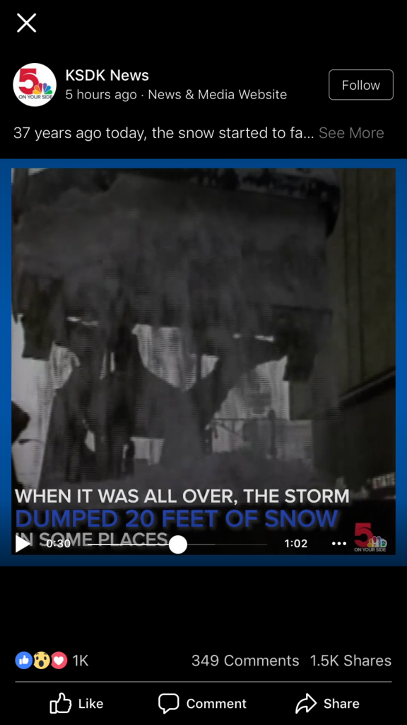 Man, the 82 blizzard gets crazier every year |
|
|
|
Post by Jeffmw on Jan 30, 2019 21:21:35 GMT -6
Is there a Heat equivalency to the Polar Vortex?
|
|
|
|
Post by snowjunky on Jan 30, 2019 21:22:20 GMT -6
Rockwood closed tomorrow.
|
|
|
|
Post by dschreib on Jan 30, 2019 21:23:04 GMT -6
I take back what I said about roads being junk. This stuff is so dry and powdery that it's not slick. I didn't touch 4WD (not sure it even works--hit 240k miles on the way home), and had no issues at all in the truck. The only problems will be where it melts and refreezes. The way it is now, it's like driving on sand.
|
|
|
|
Post by dschreib on Jan 30, 2019 21:23:30 GMT -6
Is there a Heat equivalency to the Polar Vortex? Ask Katfan. |
|


 The wind barbs at 925mb look to be perpendicular to the temp gradient but I can't identify any other specific reason. Anyone care to comment???


